|
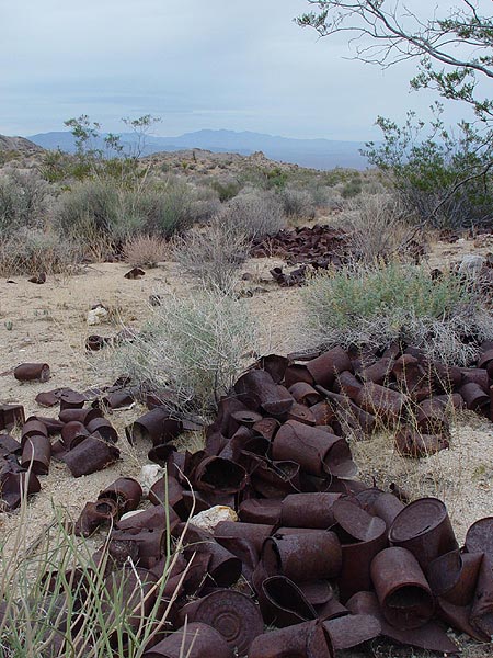
| Trash
heap left behind at the Golden Fleece Mine. |
 |
|
Some
kind of bizarre old water collection platform an storage tank in
the Little Piute Mountains. Please see the Update Below to find out what this thing is |
 |
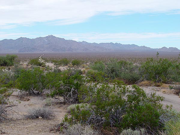
| Looking
back down Sunflower Springs Road and the Old Woman Mountains in
the background. |
 |
| The
remains of an old miners cabin inbetween the Turtle and Stepladder
Mountain Wilderness. |
 |
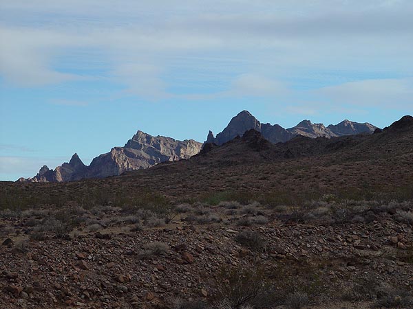
Peaks of the Turtle
Mountains. |
 |
Looking across the
Ward Valley towards the Old Woman Mountains. |
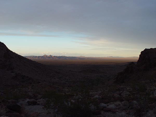 |
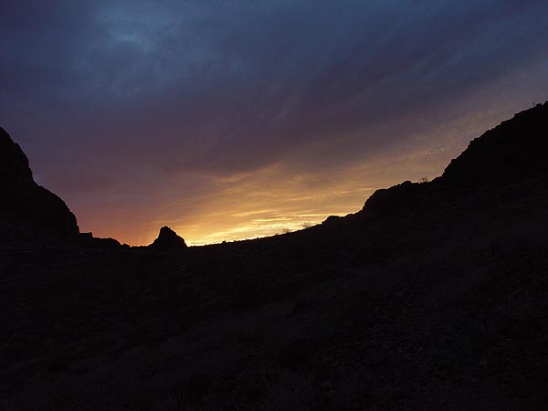
Looking out toward
the Stepladder Mountains at Dusk. |
 |
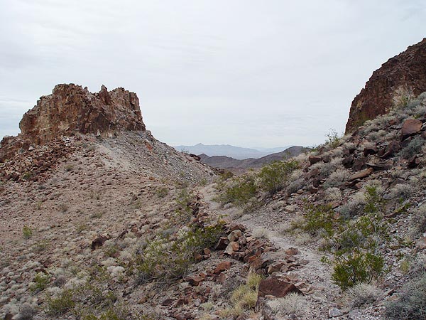
Path of the Mohawk
Springs Trail. |
 |
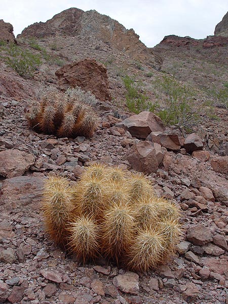
Chollas near Mohawk
Springs. |
 |
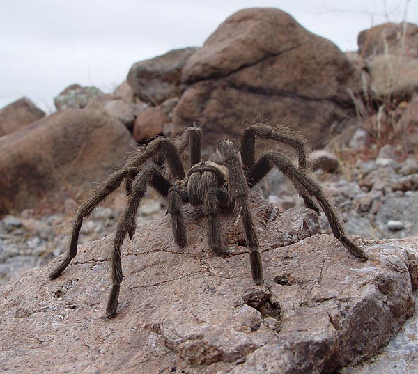
| One of the many
friends we made along the way. |
 |
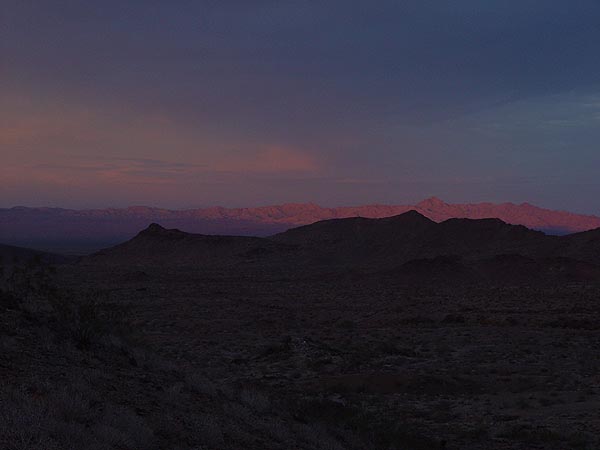
Sunset in the Turtle
Mountains. |
 |
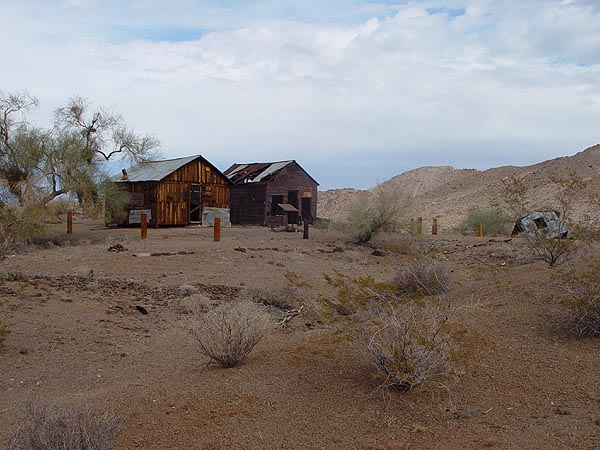
The Lost Arch Inn
Cabins. |
 |
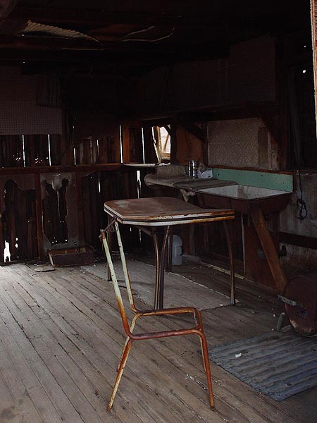
Furnishings inside
one of the cabins. Please try to leave places like this in better
condition than when you found it. |
 |
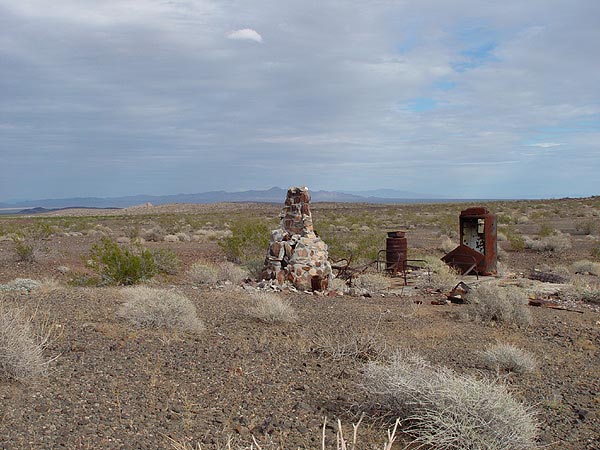
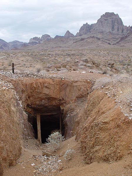
One of many mine
entrances at the Lost Arch Inn. |
 |
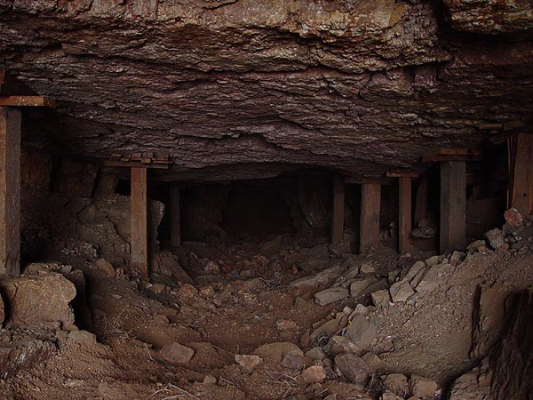
| View
inside the mine shaft. |
 |
| Sunflower
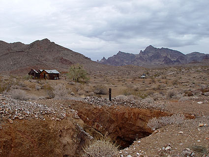
Springs Road East Mojave Heritage Trail & Lost Arch Inn Location: Mojave Desert near Arizona border south of I-40 Distance: Approximately 35 miles one way Difficulty: Easy to Moderate - Hi Clearance 4WD Recommended Time: 2 Days Attractions: Old Woman, Piute, Stepladder and Turtle Mountain Wilderness Areas, mines, Old Woman Statue, Lost Arch Inn, hikes to historic springs and great rock colleting. Maps: AAA - San Bernardino County, BLM Surface Managment Map Route Directions From Barstow, take I-40 to the town of Ludlow. Exit and fill up your gastank here as there won't be any other gas stations for the rest of the trip. Head east on Route 66 past Amboy and Chambless. When you reach Essex, make a right turn onto Sunflower Springs Road. You'll know you are there when you see the post office and an old school. This is where you leave the pavement. Sunflower Springs Road is a wide, sandy, wash boarded road that can be quite trying on your nerves at times. Go too slow and you run the risk of getting stuck in places. Go too fast and you'll rattle yourself apart. Anyway, heading down this road, you will be able to see the Piute Mountain Wilderness to the east, the Old Woman Mountain Wilderness to the south and the Ward Valley beyond. At about 7 miles in, you should come to a fork in the road. Stay to the right and travel about another 1.5 miles and you will find the turn off to the Golden Fleece Mine on your right. The mine is located approximately half a mile up the road and can be easily found by it's tailings and tin can dump. The main mine shaft is located underneath the road and enters at a steep angle. Mine shafts are extremely dangerous and should not be entered or entered with extreme caution. For me, I kept out of this one. This mine is surrounded by the Old Woman Mountain Wilderness and the road beyond is closed to vehicular travel. Double back to Sunflower Springs Road and continue heading south for approximately 3 miles. Here you should find another fork in the road with markers indicating the road to the right is the Sunflower Springs Road and the one to the left heads off on to the East Mojave Heritage Trail. On this trip, my family and I thought it best to find a camp site soon as rain was starting to come down and decided to head east on the East Mojave Heritage Trail along the little Piute Mountains. The East Mojave Heritage Trail is a bit rough and even encountered a few deep ruts caused by water erosion. Nothing to sweat over in my TJ but I could easily see how a longer wheel base vehicle or one with little ground clearance would have some trouble negotiating them. With rain starting to fall more steadily, we sought higher ground along the base of the Little Piute Mountains and setup camp. While there, we did some exploring on foot and found a peculiar concrete disk measuring about 10-15 feet across and funneled down to some kind of catch tank. I don't know who or why someone would put this here, but it looked like it had been there for a long time. The following morning, we decided to hike up a near by wash and kept on going until we reached the ridge top. From there, we found amazing views of the Ward Valley and all the surrounding mountains. After our hike and some breakfast, we broke camp and headed out. Instead of back tracking our way to the Sunflower Springs Trail, we decided to skip a planned visit to the Old Woman Statue and continue east along the East Mojave Heritage Trail. This road eventually hooks up to a pipeline road (about 10 miles since the beginning of the trail) where we made a right turn to continue heading east. In about 1.5 miles, you will come up to a very smooth and maintained power line road. Make a right turn here to head south and continue along it for about 12 miles. This road is so smooth, we found ourselves doing about 50-60 mph for most of the way down. At a little more than 12 miles down, you will meet the junction where Sunflower Springs Road intersects the power line road. This intersection is marked and should be easy to find. Make a left here and head east along this vehicle corridor in between the Step Ladder (to the north) and Turtle Mountain Wilderness (to the south). One of the first things you will notice heading along this road (besides the awesome mountain peaks) is the amazing amount of greenery. In fact, you should be able to see what looks like a row of trees stretching all the way from north to south. These tree lie about 4 miles from the junction turn off and reside along the Homer Wash. Although dry most of the year, you would almost think that water flows heavily through there on a regular basis. Through the mountains and about 11 mile in from the junction, keep an eye out for a mail box on the right side of the road. Yes, you heard right. There is an old style mail box on a post marking the beginning of the Lost Arch Inn trail. When you come to it, make a right and follow the road a little over a mile and then turn left at the wilderness boundary maker. Continue following the road about another 3 miles until you come to a fork. On this trip, we went to the right which leads to the Mohawk Spring trail head and setup camp for the night. The following morning, we hiked up the Mohawk Springs trail which can easily be found by rock cairns that have been painted white. Along the way, you will find many fine specimens of Chalcedony Rose, Agate and Jasper. If you keep a close eye out, you may even encounter a Tarantula or two. The area also hosts a number of petroglyphs left behind by the Palco-Indians. Unfortunately, the spring itself was quite dry when we got to it. After our morning hike, we packed our things for the last time and headed back down to the fork in the road and turned right. A couple miles on this road and you should see a well traveled road to your left. If you keep going straight, the road will take you to the Carson's Well trail head. Turn left and you will find the Lost Arch Inn and its mines. The Lost Arch Inn consists of two cabins, mines everywhere and some junk left over from Charlie Brown and his partner Jesse Craik. These two miners prospected for gold and silver in the Turtle Mountains from 1922 - 1948. The cabins are in very poor shape from neglect and vandilism so please try to leave them in better condition than when you found it. The mines in the immediate area can be a lot of fun to explore but be sure to take extreme caution when entering them. A few are quite steep and difficult to make your way back out. Plan to spend some time here as there is plent to explore. Fortunatly, the Lost Arch Inn trail is a loop so when you are ready to leave, just keep following the road you were on until you hook back up to Sunflower Springs Road. From there, make a right and keep heading east until you reach U.S. 95. Along the way, you will come across another mighty wash called the Chemehuevi which will be very lush with vegitation like Homer Wash. Once you reach the Highway, make a left and head north to Needless where you can find gas, food and civilization again. That's about it. From here, all you need to do is make your way home. Please let me know if you have any questions regarding this trip. Update - 09/05/04 "In case anyone hasn't written you yet, this is a classic quail guzzler, used by other birds and small mammals in the desert. The BLM and various volunteer groups have planted hundreds (and perhaps thousands) in desert and canyon areas over the years, partly to promote bird hunting. The California desert guzzlers are not generally more than 50 years old -- many are more recent -- and most designs offer the smaller animals protection from larger ones (such as coyotes) in addition to limiting the size of the animals that can drink from the water can under the guzzler roof." — Tom Perkins |
 |