 |
| How
to Get There
• From the Los Angeles area, head east on HWY 60, 91, I-10 or I-210 until you hook up with I-15. • Take I-15 north over the Cajon Pass and head towards Barstow. • From Barstow, keep heading east on I-15 for about 35 miles and then exit the freeway at the Afton Canyon exit. • From the exit, make a left turn (heading north) over the freeway and follow the paved road as it hooks around to the west and then ends at a dirt road heading north again. This is where the trail begins. • Heading north, you should come up to a fork with the road in about 3.5 miles. The road to the right will lead you to a mine and an unmarked dry lake which just happed to be full when we were there in February 2005. If you stay to the left, you should reach a powerline road in about 3.5 miles. • When you reach the powerline road, you will be sitting in front of the Fort Irwin National Training Center. The road from here only goes left or right. Make a right turn which will take you on a north-east heading. • At about 6 miles down this road, you should be able to see the West Cronese Dry Lake to the south as well as the Cronese Mountains. • Approximately 11 miles from where you made your turn, you should crest a summit through the edge of the Soda Mountains offering a spectacular view of Red Pass Dry Lake (again, full when we were there) • Down from the summit, there is a small road which heads north along the western edge of this dry lake. Be mindful that within a very short distance, you will be inside the Fort Irwin National Training Center and you should see what I'm guessing are military buildings just on the other side of this lake. • Continuing north-east along the powerline road, you should come up to a turn off to the south in approximately 12 miles. This washed out and rough road will take you up to 2 mines. The mine are fun to visit but be prepaired for a long and slow going ride. • Highway 127 is only about 6 miles to the east just past Silver Dry Lake. Once again, this lake was completely full when we were there and quite impassible. If the lake is still full when you visit, be sure to stay to the left when you approach the fork in the road which will take you around the north side of the lake on higher ground. • From Highway 127, you can head north to Death Valley or head south to Baker and home. Resources • AAA San Bernardino County Map • BLM Surface Managment Status Map |
| Soda
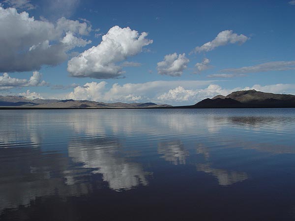
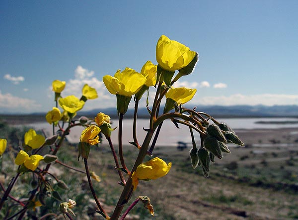
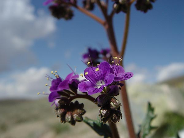
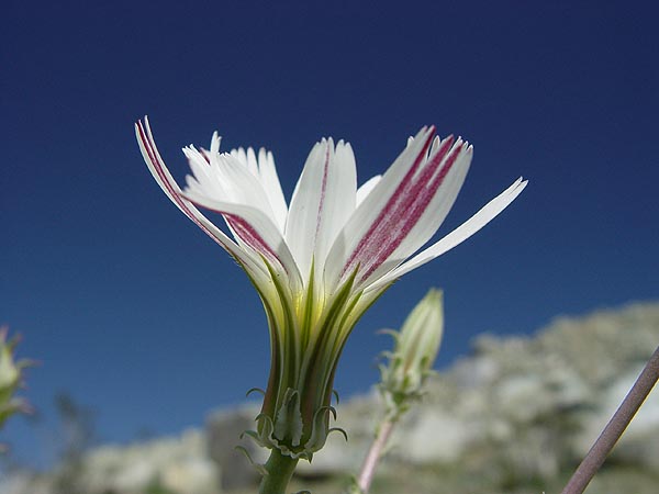
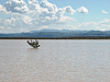
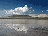
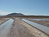
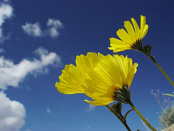
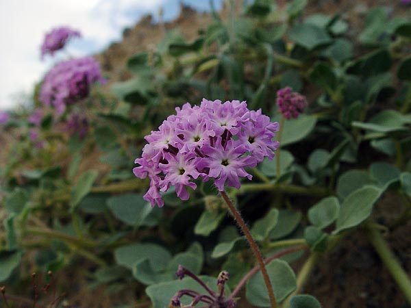
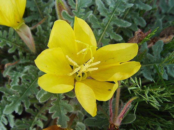
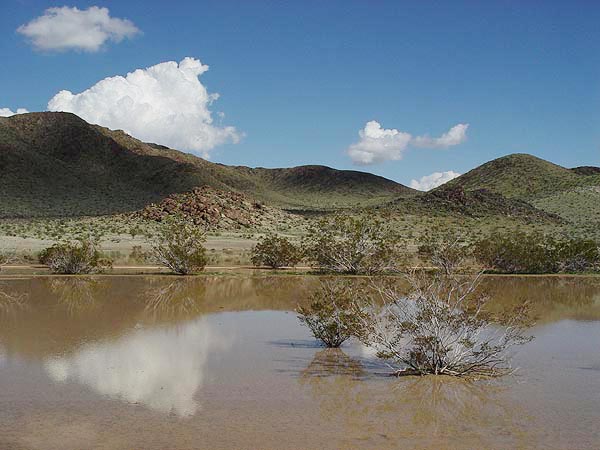
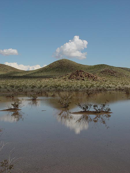
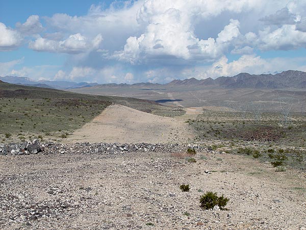
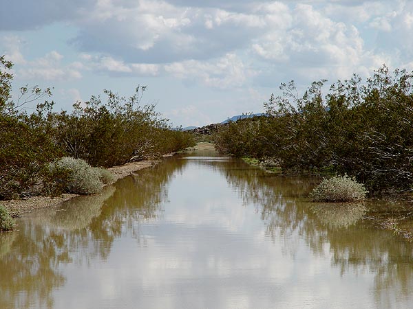
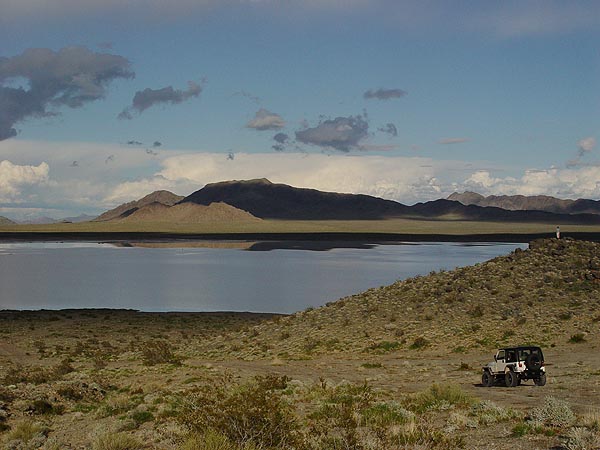
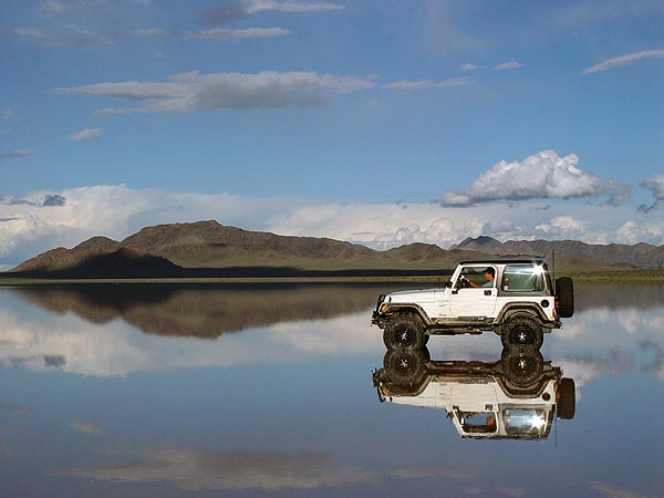
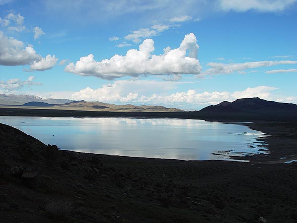
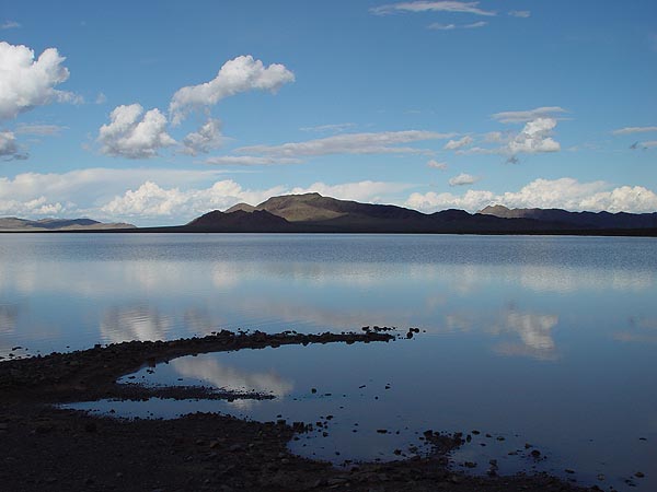
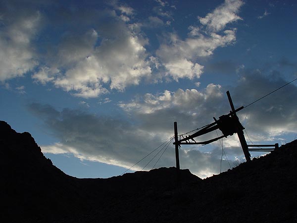
Mountains - Mojave Desert, CA 02/26/05 Oh my dear God, with all the rains we've been having here in Southern California during the early month of 2005, the entire Mojave Desert has been transformed into a world I have never seen before in my lifetime. All the dry lakes were completely full, everything was green and there were flowers everywhere! Need I say, my family and I decided to take make every opportunity to head out to the Mojave Desert every single weekend we could this year to enjoy this once in a life time experience and on this particular trip, we explored the Cronese and Soda Mountains. Our expedition began at the Afton Canyon exit just off the I-15 but unlike many trips we've taken in the past, we headed north away from Afton Canyon. This was in fact the very first time we taken this route and let me just say it was amazingly beautiful right from the get go. Right off the freeway, there were yellow flowers blanketing either side of the short paved road leading up to our trail and beyond that, we would find tons more and of all types. The first real stop we made along the way was at a small mine about 3 or 4 miles into the trail. What caught our attention was a small lake that didn't show up on any of my maps. We easily spent about an hour or more here photographing all the wonderful flowers and lake. Continuing up the trail, we encountered several sections of the road that were completely submerged in moderately deep water (man I love owning a Jeep) as well as the valley around it. With islands of Creosote bushes everywhere, this truly was a beautiful sight to see. Again, my family and I couldn't resist spending a good deal of time taking pictures, skipping rocks and just taking in the scenery here. Once we got to the main power line road, we were surprised to see what looked like a huge scar across the desert floor extending as far as the eye could see. At first, I thought this was the boundary of the Fort Irwin National Training Center but upon closer examination, I found this to be where a trench had been dug and a pipeline buried in it. This was a very sad sight to see. Heading north-east, we passed through a huge valley with a view of the West Cronese Dry Lake (full of water) and Cronese Mountains in the background and then climbed up the western edge of the Soda Mountains. From the top of the pass, we were treated to a breath taking view of Red Pass Dry Lake, which was of course, completely full of water. Driving up to the edge of Red Pass Dry Lake, all I could think of was how completely out of place, foreign and stunning it looked out in the middle of the Mojave Desert. My family and I decided to have lunch and spend the better part of the day here. Looking north across the lake, you could see a whole host of buildings I can only guess are used for military training. I really wish I could have taken a closer look but the smarter half of me convinced me we were close enough. As final stop, we decided to make one last stop and check out a couple of mines on the north side of the Soda Mountains. Due to all the rain and flash flooding this year, the road leading up to the mines had be severely washed out in many places requiring 4WD and a lot of clearance at times but even where the road was intact, the ride up was quite rough and very slow going. Having said that, the view from the mines was beautiful as well as were the rock formations in the deeply carved canyons they resided in. I have made note to myself to return someday and camp here. Heading back to pavement, the road we were on was supposed to cross through Silver Dry Lake. However, when we got there... you guess it, the lake was very full with knee deep water, sticky mud and really quite impassable. Fortunately, there was a bypass road that skirted the northern side of the lake on higher ground and ended at Highway 127 too. This really was a trip to remember and if you've got the time and the means, I would highly recommend you seeing this once in a lifetime experience.
|
 |