|
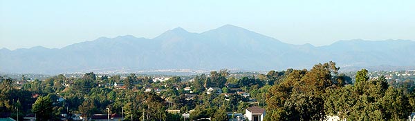
| A view
of Modjeska on the left and Santiago Peak on the right all the way
from Laguna Niguel. The Saddleback. |
 |
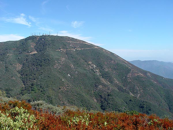
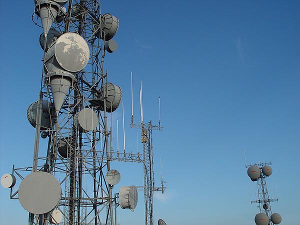
| View
of Santiago Peak (Old Saddleback - elevation 5687) with all it antennas
on top. |
 |
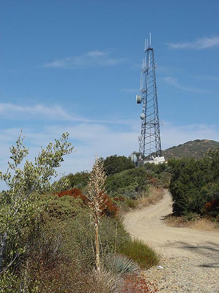
| You
will see a whole lot of these along the way. |
 |
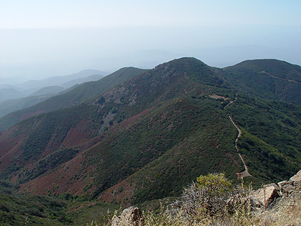
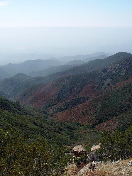
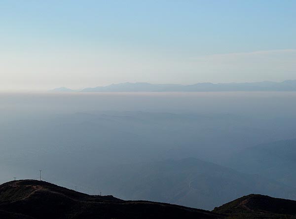
| View
towards the south-west towards Trabuco Canyon. |
 |
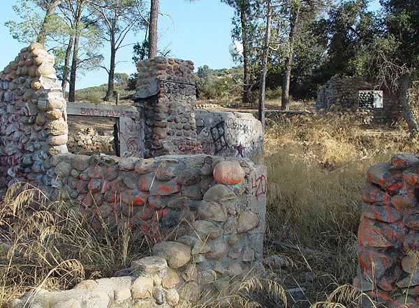
Beeks Place in ruin
and unfortunately covered with graffiti. |
 |
|
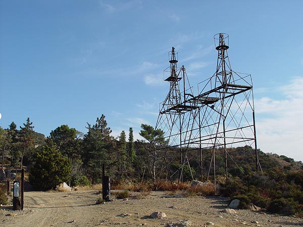
I haven't a clue
as to what these antenna like structures are but they were apparently
erected in 1941. At least according to the inscription on the concrete
foundation anyway. |
 |
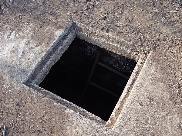
Up the hill is an
opening to some a cistern or underground storage vault. |
 |
|
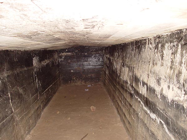
Here's a shot of
what it looks like inside so you don't have to climb in and get
stuck. I hung my head in upside down to take this shot. |
 |
Did I mention that
you will see a lot of antennas along the way? |
 |
| Here is a view
from Sierra Peak (elevation 3045) looking north towards the 91 FWY
and Chino Hills State Park. |
 |
| Main
Divide Road Separating Riverside and Orange County is a mountain range know as the Santa Ana's. Most of it resides within the boundaries of the Cleveland National Forest and it has amazing views, plenty of hiking trails and even a few dirt roads you can explore. One such road traverses along the ridge top of this range and it is called the Main Divide or Main Divide Truck Road. Trail Information Location: Santa Ana Mountain Range in the Cleveland National Forest, CA. in between the 91 FWY and the 74 Ortega HWY. Distance: Approximately 35 miles one way Difficulty: Easy - Hi Clearance 4WD Recommended. Time: 4-5 hours with stops along the way Attractions: On a clear day, you will have views clear out to the ocean (sometimes even Catalina Island) and all the way out to the San Jacinto mountains at the same time. Stand on top of Santiago (Old Saddleback) Peak and visit Beek Place ruins. Required Permits: You will need to have an Adventure Pass to park anywhere along this route. A pass can be purchased at any Sport Chalet or Ranger Station for $5 a day or $30 for an annual pass. Being a ridge route, there are few to no good camping spots along the way. Click here to see a PDF Trail Map How to Get There There are several ways to gain access to this trail but I would recommend starting from highway 74, also known as the Ortega Highway. From Los Angeles, head south to San Juan Capistrano and then east on 74. Take this road about 22 miles until you reach the El Cariso Fire Station. Make a left turn on to 3S04 (Main Divide Road) and head up about 4 miles until you reach a fork. Take the dirt road on the right which is 3S04 and where your adventure begins. If you stay on the paved road on the left, you will end up back on the 74 HWY. Just a few miles in, you should be able to see amazing views of Lake Elsinore, the Temescal Valley and the San Jacinto Mountains. There are numerous hiking trails in this area and one of the more famous ones is the Holy Jim trail. Holy Jim apparently was a bee keeper back in the late 1800 who had a knack for cussin a lot. This actually earned him the title 'Cussin Jim' but for some reason in latter years, it got changed to 'Holy Jim'. At about 12 miles in from where the dirt road began, you will find yourself on top of Santiago Peak (aka. Old Saddleback), Orange Counties highest peak at 5687 ft. From here you can see all the way out to Santa Catalina Island on a clear day. Like many of the peaks along this route, there is a mass of radio antennas here and you can get incredible reception. If you are running short on time, you can leave the Main Divide Road at Maple Springs Road 5S04. The junction for this road is about 4.5 miles from Santiago Peak and just past Modjeska Peak. The route will be on the left hand side and is posted. This road will lead you through Silverado Canyon on a paved road and will end up on County Hwy S18 at the bottom of the mountain. For those of you feeling more adventurous, stay to the right to continue on. About 30 miles in and close to the end of this trail is some kind of neat old homestead called Beeks Place. The few building that are still standing have been heavily vandalized, covered with graffiti and are basically in ruins. It's really a frustrating sight to see. At the far end of this place you will see a couple of odd looking antenna like structures that were apparently erected back in 1941. If you do a little exploring on the hillside behind the structures, you will also find a cistern with a square opening on the ground. Although it is not excessively deep, I would advise against climbing into it. For those who are curious, I have provided a pic of what it looks like inside to the right. If you visit this place, please help us try to preserve this place by picking up some of the crap the jerks before left behind. Leaving Beeks Place (the road heading south-west leads to a locked gate), head north until you reach Oat Flat and then make a left turn towards the fence and antennas. There should be a posted sign stating that the road in this direction is narrow and rough. The road to the right will take you down to Corona. Anyway, keep following this road until you reach Sierra Peak which is the last one you will encounter with antennas on top of it. As you approach the peak, look for a road to your left with U.S. Forestry signs posted. This is where you will need to turn to get back to the main highway but before you do, be sure to go to the top first. From here, you will be able to see great views of the Chino Hills. Coming down from Sierra Peak you will encounter a confusing fork in the road. You will need to take the one back on the far right. Here you will see the aftermath of a large brush fire that occurred several years ago. A lot of the vegetation is coming back strong now and actually looked quite beautiful when I was there in the beginning of October. This final stretch of road is quite soft from all the ash and has several mild off-camber sections so take your time. This trail will end in Coal Canyon at the 91 FWY. Additional Information I took this trail on October 6, 2003 and when I got to the end, I could not get on to the freeway. Apparently, they were doing work on the on-ramps and had put of fences around everything. Fortunately for me, they gates were not locked and we were able to push one open and get out on a very rough on-ramp heading east. Before you take this trail, you might want to check the status of this construction to see if they are done. |
 |