 |
|
How
to Get There
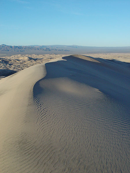
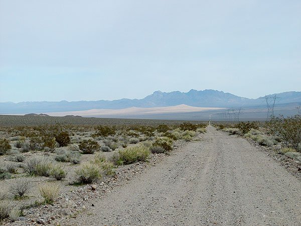
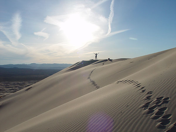
• From the Los Angeles area, head east on HWY 60, 91, I-10 or I-210 until you hook up with I-15. • Take I-15 north over the Cajon Pass and head towards Barstow. • From Barstow, head east on I-40 for about 50 miles and then exit the freeway at the small Route 66 town of Ludlow. Depending on how much of a gas hog your vehicle is, Ludlow is your last chance to fill up for miles. Need I say, it's better to be safe than sorry out in the desert and I would recommend tanking up here. • From Ludlow, take the road under the freeway bridge and head north. Just past the 76/Dairy Queen gas station, the pavement will end. The dirt road ahead will be the beginning of your trail. • Head north towards Broadwell Dry Lake for about 2 miles and then make a right onto the pipeline road. • At about 7 miles, you will be at the foot hills of the Bristol Mountains and the road will split. You can take either road as they will eventually hook back up to each other but I chose to stay to the left. • Staying to the left and about a mile up the road, you should come up to a small but pretty sand dune section. • In about another mile, you should crest the summit of the Bristol Mountain range. From here, you will have a great view of the Kelso Sand Dunes which are about 10 miles away. • To access the Kelso Sand Dunes, you can find a place to park somewhere along side the road and hike to it, or you can go all the way to Kelbaker Road, make a left and head north for about a quarter of a mile and then make another left onto the first dirt road heading west. This road goes about 4 miles in and will take you closer to the base of the dunes. The Hike The Kelso Sand Dunes are approximately 600 feet high and for the most part are easy to traverse. However, towards the top, the sand is very steep and will require some effort to climb. Please make sure to carry plenty of water, sun screen, a hat and your head. This is the desert so take your time and think smart. You should allow for about 2 hours for the trip up and back. If you're a shutter bug like my wife and I are, allow for more. Resources • Desert USA - Kelso Dunes |
| Kelso
Dunes & Bristol
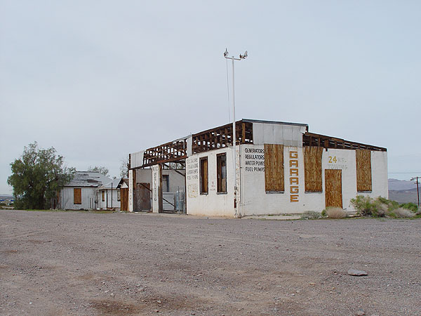
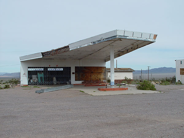
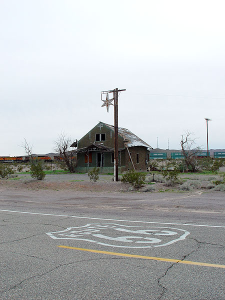
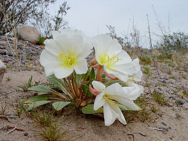
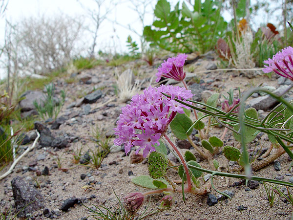
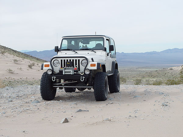
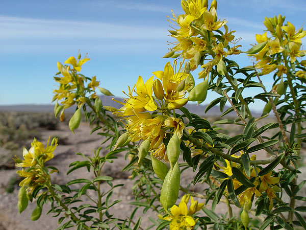
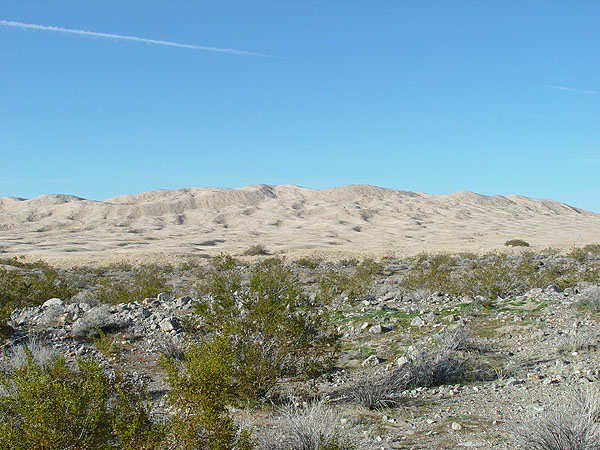
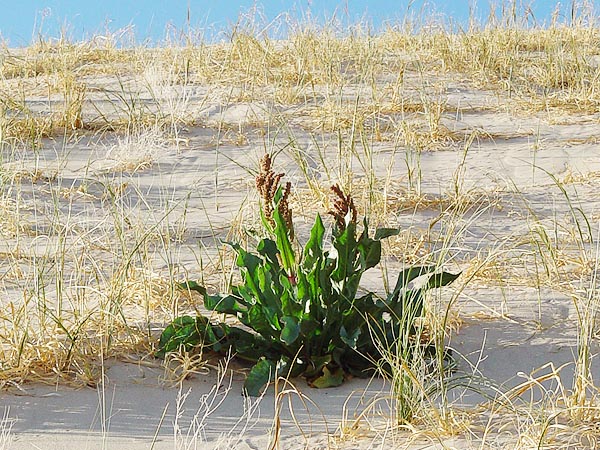
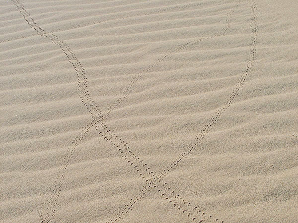
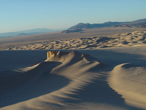
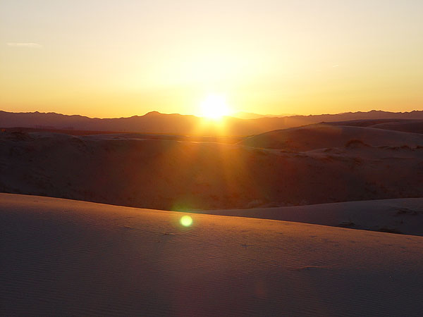
Mountain Wilderness Mojave National Preserve 02/05/05 Although I have visited the Kelso Sand Dunes several times before, I had never climbed to the top of them and had always wanted to. Needless to say, this was our destination for the day. The Kelso Sand Dunes are located in the Mojave National Preserve near the I-40 and is about four hours away from the Los Angeles area. Pretty much any vehicle can access these dunes as virtually all but 4 miles of the trip can be done on pavement. To make thing a little more interesting for us, my family and I decided to leave the pavement early, do some exploring along the way and reach the dunes by cutting through the Bristol Mountain and Kelso Dunes Wilderness Areas. After hours of driving, our adventure really began at the small town of Ludlow. Once, a welcome stop for exhausted travelers along the famous Route 66 (aka National Trails Highway), some evidence still remains that this place was once a growing and thriving town. However, with the addition of I-40, Ludlow has been reduced to nothing more than a couple of gas stations and a host of crumbling homes and buildings. Still, it has a lot of charm and I was left with a wonder what life would have been like in the early days of highway travel. Heading north, the pavement ended abruptly just past the 76 gas station and we hooked up with our pipeline road just a couple of miles further up the road. From here, we headed east where we would be flanked by the the Kelso Dune and Bristol Mountain Wilderness Areas for the next 15 miles or so. Even with all the rains we've had this winter, you can see that this part (east side of the Bristol Mountains) of the Mojave Desert receives very little precipitation. The Creosotes here were sparse, very short and with the exception of some grasses, very little else was growing. However, as we approached the summit, more and a diverse amount of vegetation could be found. In fact, from the summit to the Kelso Dunes, we came across some beautiful Dune Evening Primroses, a ton of Sand Verbenas and a few Bladder Pods in bloom. Unfortunately, the road we were on never actually reaches the Kelso Sand Dunes. So, once we got to a point where we felt close enough to them, we just parked our Jeep on the side of the road and hiked the rest of the way. From the road, I'd say it was only about .5 miles to the base of the dunes and then maybe another 1.5-2 miles more to the very top which is about 600 feet up. For the most part, this is a very easy hike but the last 100 yards or so was very steep and exhausting. We literally had to get down on all fours at one point and for every three steps you took only one would move you forward.... but let me tell you, it was totally worth it!! The view from the summit was simply unbelievable. Unlike other sand dunes we have visited, the Kelso Dunes are oddly pinkish in color. Apparently, this is because they are made of many golden rose quartz particles. Also, these dunes are heavily vegetated and while we were there, we came across some beautiful Canaigre (aka Wild Rhubarb) not yet in bloom. In my opinion, the best time to visit these dunes is at sun up or close to sunset where the low angle of light allows you to really see the delicately sculpted sands and the unique tracks left by animals and insects. If this is just a day trip for you, Kelbaker Road is just a couple of miles to the east and it will take you back to I-40 to the south or I-15 to the north.
|

  |