|
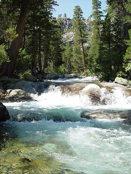
| Here's
a shot of how amazingly glass clear the water is in Pyramid Creek |
 |
| View of Horsetail Fall from the trail | 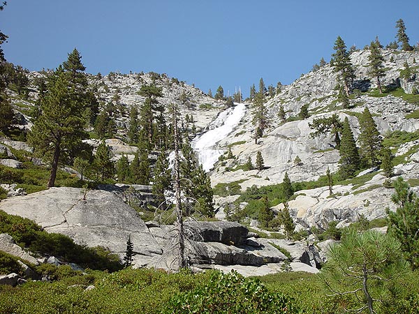 |
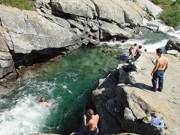
| People
diving into the frigid waters of Pyramid Creek close to the Falls |
 |
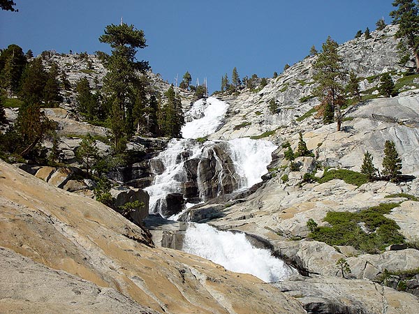
| The
base of Horsetail Falls |
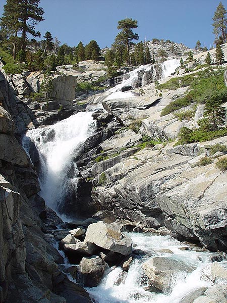 |
| Horsetail
Falls 08/27/02 Location: Desolation Wilderness - Tahoe, CA Distance: 3 miles round trip (1.5 hours) Difficulty: Easy/Moderate Elevation gain: Approximately 675 feet If you've ever been up to South Lake Tahoe by route of U.S. Highway 50, then you've probably seen a spectacular ribbon waterfall to the north just as you approach Echo Pass Summit. This is Horsetail Falls and it is created by Pry amid Creek flowing down the steep glacier carved granite faces of the Desolation Wilderness. Going up to the falls is a short but beautiful hike on easy to moderate terrain. Please take caution while on this trail and parents should keep a close eye on children at all times. The rocks can be quite slick in places and several deaths have occurred here over the years. The falls look great all year long but looks the best at the peak of snow melt which is from about the middle of June through the end of July. If you plan on staying the night, a Wilderness Permit will be required. How to Get There From South Lake Tahoe, take U.S. Highway 50 south. About 6.75 miles from Echo Summit, you should see a well developed parking parking area for Twin Bridges and the Pyramid Creek trail. There are flushing toilets and running water here but parking will set you back $3 per vehicle for the whole day. When my family and I were here, Pry amid Creek was very full and flowing swiftly. Close the falls, there was a small pool where people were diving in to the frigid waters to cool off. Again, please think smart be careful along the waters edge. Please let me know if you have any questions. |