|
| |
Our Destinations
• Saratoga Springs
• Armagosa River
• Hungry Bills Ranch
• Bad Water
• Darwin Falls
Our Route for this Trip
• From the Los Angeles area, head east
on HWY 91, 60, I-10 or I-210 until you reach I-15.
• Take I-15 north towards Las Vegas.
• At about 60 miles east of Barstow, exit the freeway at the town of Baker, top off your gas tank, stock up on any last minute goodies and then head north on HWY 127.
• Almost 30 miles north of Baker, you will approach Salt Spring Hills and there will be a wide unpaved road to the left heading west. Turn here and take this road into Death Valley.
• In about 6 miles, you will come to a road on to the right heading north. This road will take you to Saratoga Springs and there should be a marker indicating as much.
• There will be a fork in the road about 2.5 miles in and you will need to go left to get to Saratoga Springs. When we were here, the road quickly disolved into a deep, thick and sticky pudding. There were several SUV's parked here but we were able to navigate past this section with ease in our Jeep.
• Backtrack out the way you came in and then when you reach the main road, make a right which will take you north into Death Valley.
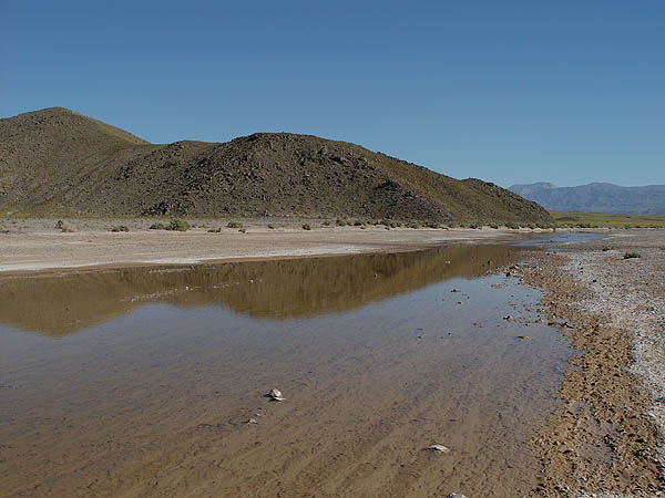
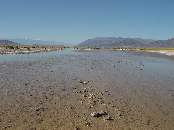
• About 17 miles from the turn off, the road will cross through the Armagosa River. This river was full and flowing when we were here but the ground was solid and posed no problems.
• Keep heading north for about 12 miles and you should connect up with HWY 178.
• Take the 178 north about 4 miles and then turn onto West Side Road which will be on your left.
• The West Side Road heads north and basically paralles the 178. About 14 miles up, you should reach Johnson Canyon Road which will be on your left. It should be marked and easy to find.
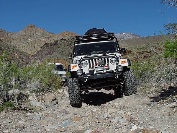
• Johnson Canyon Road is a very slow climb up into the Panamint Range and in places, the road is heavily rutted due to all the rains this year. Although the road is only 10 miles long, be prepaired for a drive for well over an hour to reach the end.
• Again, due to all the rains we've been having this year, the road effectively ends for all but the toughest vehicles about a quarter mile from where it used to end. If you have a locked and lifted Jeep, this is about the most fun you will see on the entire trail.
• The only way out is from the way you came. Back at the West End Road, make a left and head north until you reach HWY 178.
• Once you reach the 178, make a right turn and head south for about 10 miles. This will take you to Bad Water (which was totally full of water when we were there) which is a must see while in Death Valley.
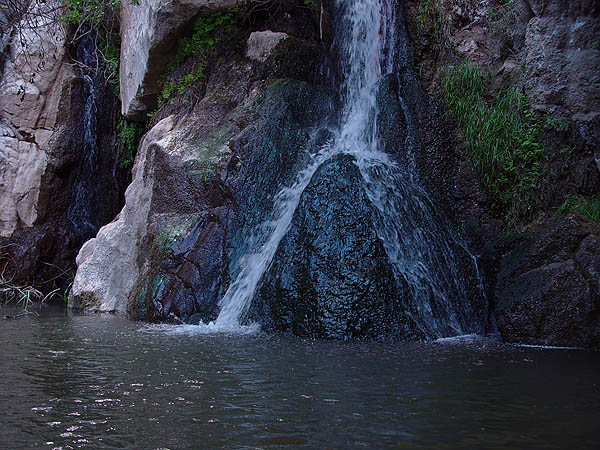
• From Bad Water, you can head home by heading south to Shoshone and HWY 127 or, you can head up north like we did, make a left at the HWY 190 junction, gas up again at Furnace Creek, continue north past Stovepipe Wells, climb over the Panamint Range and then make a stop over at Darwin Falls which a dirt road leading to it will be on the left just past Panamint Springs.
•
Darwin Falls will be up about 2 miles from HWY 190 on the dirt road.
• Leaving Darwin Falls, make a right turn so that you are heading east and backtrack the way you came a bit until you reach Panamint Valley Road. Make a right turn which will take you south to Trona, Ridgecrest and then back to Los Angeles on HWY 395 or 14.
Resources
• AAA Death Valley Map
• National Geographic Topo Map
|
|
Desert
Wildflowers Trip 2005 - Death Valley, CA
03/12/05
Now, I've been coming out to Death Valley National Park, CA since I was a kid and over the last 10 years, I've been coming out on a more regular and frequent basis. During this time, I have never... and I mean never, seen this place look so amazingly beautiful. Due to all the rains we've been having this year, Death Valley has become a completely different park covered in greenery, wildflowers and water just about everywhere you look. Unfortunately, this may be a once in a lifetime experience and if it is, I am certainly glad that I got a chance to see and experience it for myself.
Saratoga Springs
Starting from the southern border, my family, friends and I decided to begin our expedition by breaking off Highway 127 before the small town of Shoshone and headed up into Death Valley by way of the well traveled and easy graded dirt road known as Harry Wade Road. Aside from our desire to get off the pavement sooner than later, we had planned to make our first stop at Saratoga Springs which is only about 10 miles off the highway.
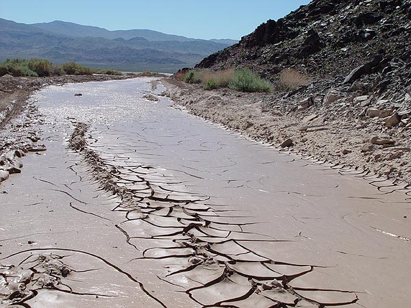
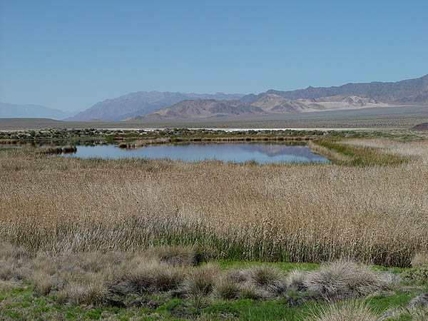
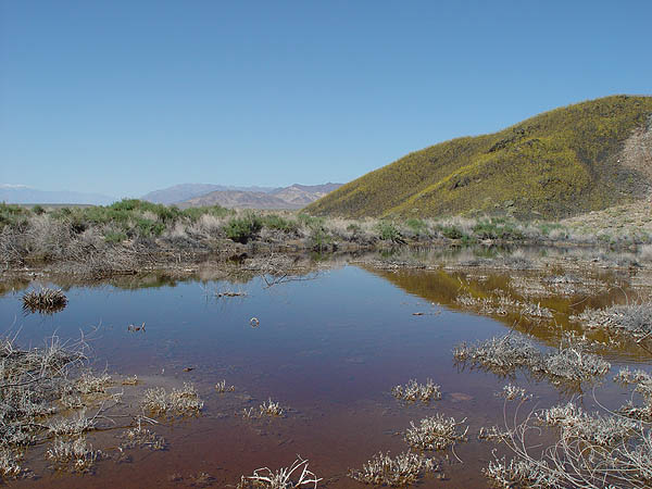
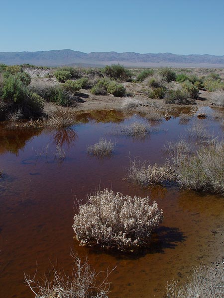
Saratoga Springs is home to three all-year ponds and home to one the several varieties of Pupfish. Apparently, these ponds are also a seasonal habitat for a multitude of migratory birds. As we made our approach to the springs, the road leading to it progressively got wetter, stickier and eventually turned into a deep soup of chocolate pudding about a mile from the parking area. By the looks of things, several SUV had attempted to make the crossing but got bogged down, backed out, parked their vehicles and then its occupants hiked the rest of the way in. After accessing the situation, we decided to give it a go and with a little effort, we made our way through the muck without incident. Once at the parking area, you will still have to hike in about half a mile to reach the ponds. This oasis in the desert really is a odd gem in an otherwise harsh environment and it was especially beautiful this year with the addition of all the lovely desert wildflowers surrounding it. After spending a couple of hours hiking around Saratoga Springs, checking out the thousands of Pupfish, frogs and wildflowers, we decided to make our way to our next destination, the Armagosa River. |
 |
 |
 |
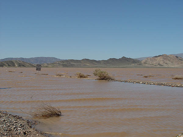
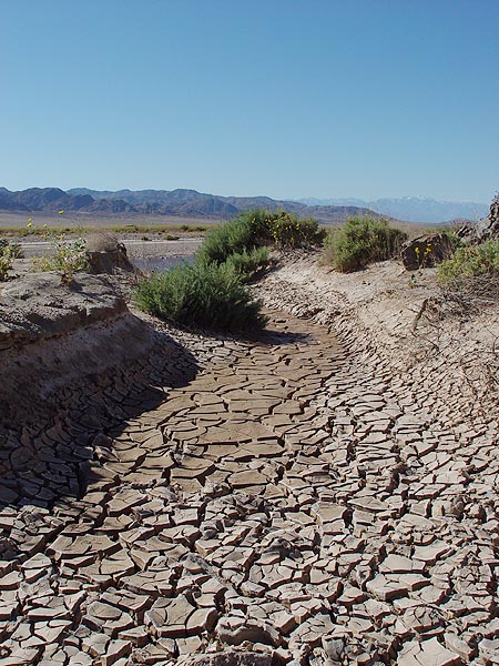
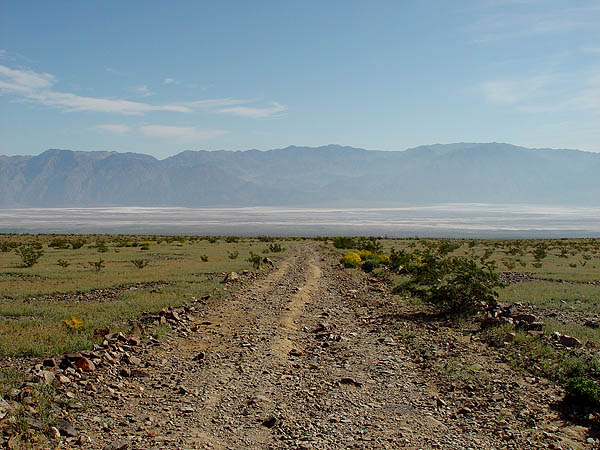
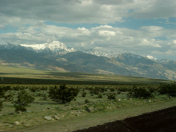
| This is actually a shot of Silver Dry Lake just outside of Death Valley |
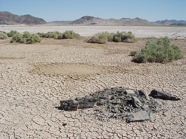
Don't let the dry ground fool you. The muck is just under the surface |
The road into Saratoga Spring was like driving in deep chocolate pudding |
 |
 |
 |
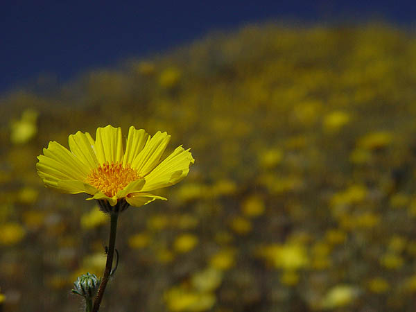
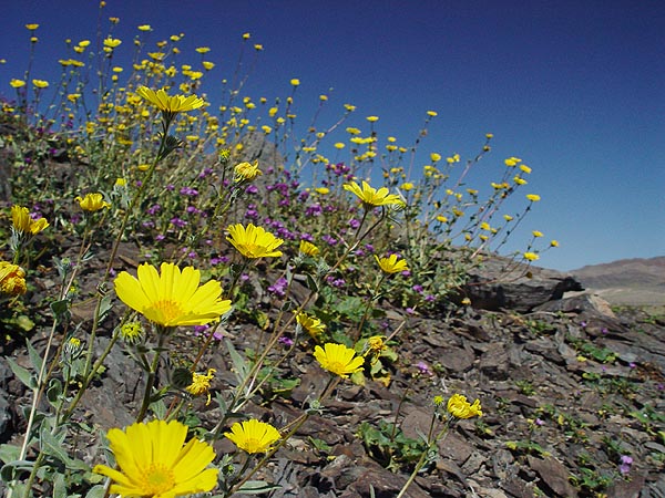
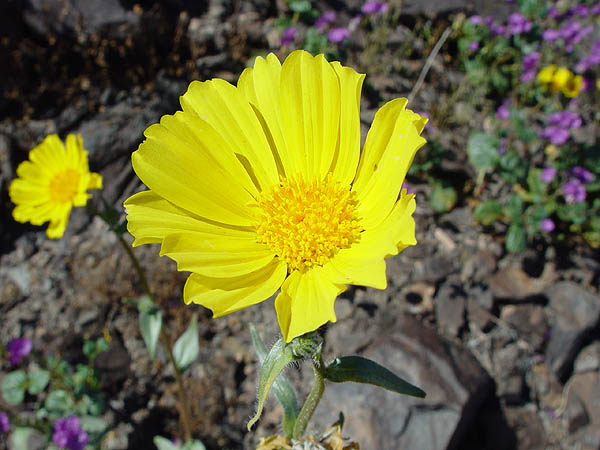
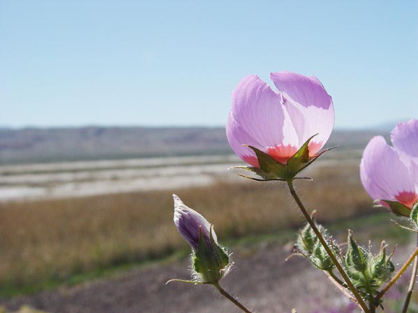
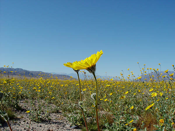
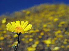
| Desert Sunflowers |
Desert Sunflowers |
Desert Sunflowers |
 |
 |
 |
| |
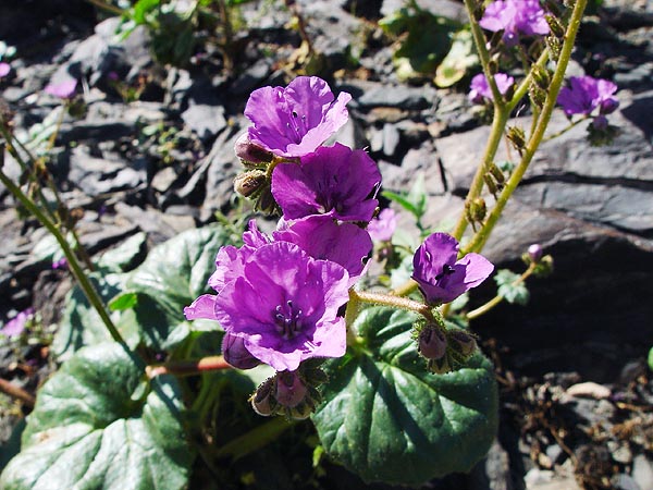
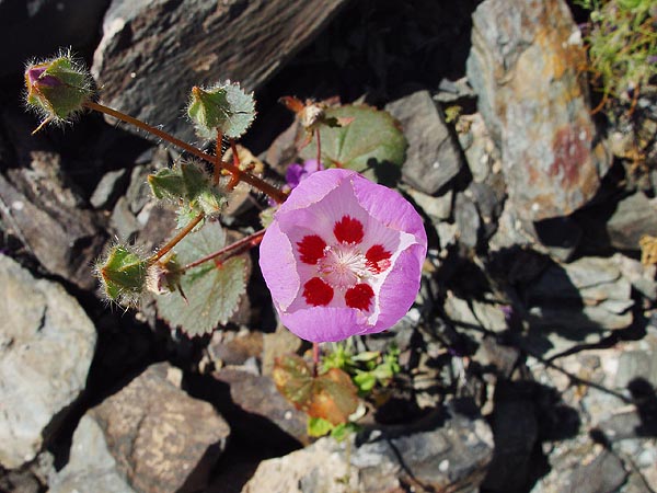
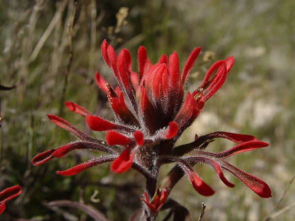
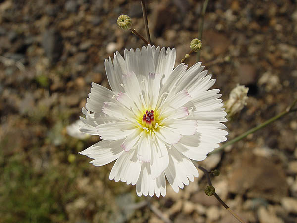
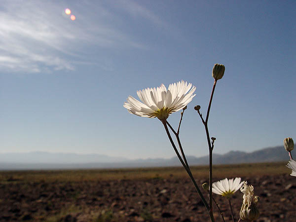
Desert Five Spot |
Desert Five Spot |
 |
 |
 |
 |
 |
 |
| Saratoga Springs |
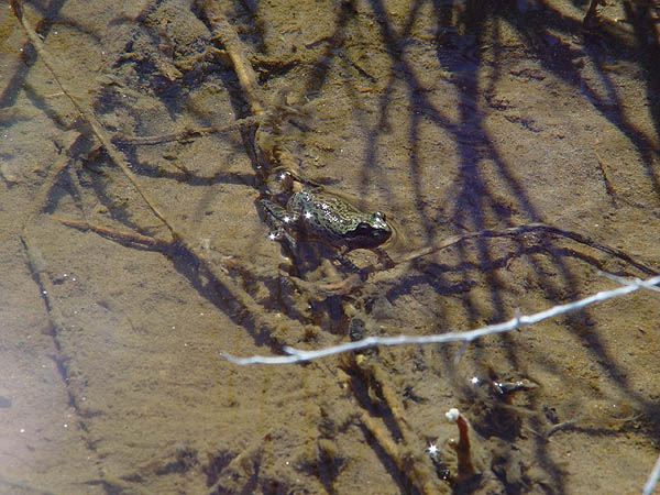
There were a ton of frogs everywhere |
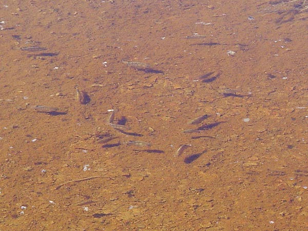
Saratoga Springs Pupfish |
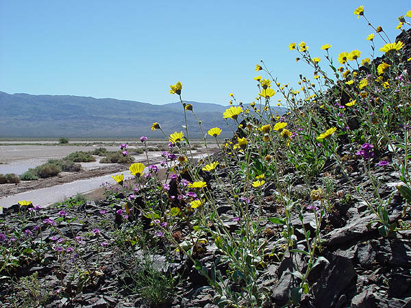
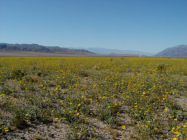
Armagosa River
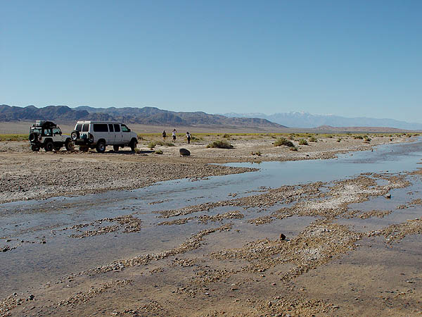
Back on Harry Wade Road, we continued to make our way up north into the valley floor and about 17 miles later, we reached our next destination for this trip, the point where Harry Wade Road crosses the Armagosa River. So why was this particular point of such a keen interest to us? Well, it is in my opinion one of the best places to see the explosion of desert wildflowers (particularly the Desert Sunflower) in Death Valley. Unlike the display at Jubilee Pass and Ashford Mills area that was being touted as the best viewing area online and in the news, the Armagosa River area was little known to most and saw only two other vehicles the entire time we were there (as opposed to the hundreds if not thousands at the other locations). Standing at the edge of the flowing river and looking north, we were treated to a sea of golden wildflowers as far as the eye could see. I truly feel fortunate to have seen this amazing display and would be surprised if I ever saw it again. With the day waning, we decided to pack up our things and high tail it to Johnson Canyon which was our final destination of the day and where we would setup camp. |
 |
 |
 |
 |
 |
 |
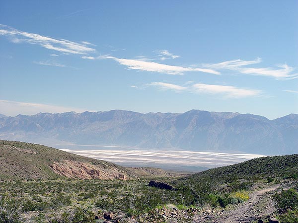
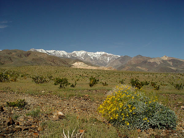
Making our way further north, we eventually hooked up to the 178, made our way past all the tourists and then turned back off the pavement on to West Side Road. Much like Harry Wade Road, this is a well maintained graded dirt road and you really can make good time on it. Johnson Canyon Road was only about 17 miles north of where we started and we got there in no time at all. This was a good thing as the drive up the Panamint Range is easy but very rough and slow going. To cover a short 10 mile distance, it probably took us easily over an hour, maybe two to reach the end. As you make your way up, be sure to look back ever now and then to take in the awesome view of the valley floor below. Towards the end of Johnson Canyon, the road became heavily rutted with a good size stream cutting though it and it was pretty much impassible to all but the most capable rigs. This last length of trail was a lot of fun and easy for my Jeep but I was blown away that my friends highly modified Sportsmobile 4x4 Van was able to keep up and without any signs of struggling. By the time we reached our campsite, the sun had already set behind the mountains. That night, we ate Brazilian style fillet mignon and then went to sleep to the sound of water rushing and frog croaking.
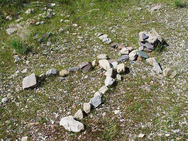
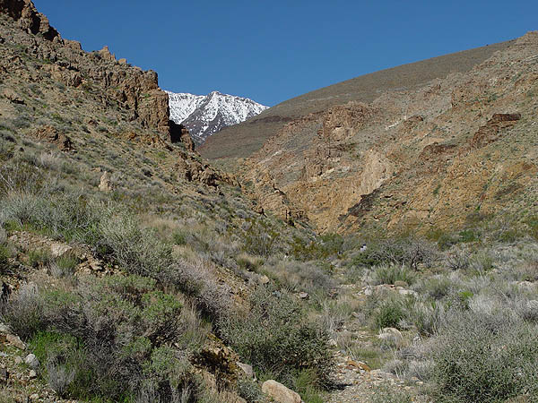
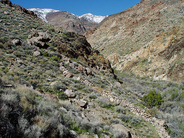
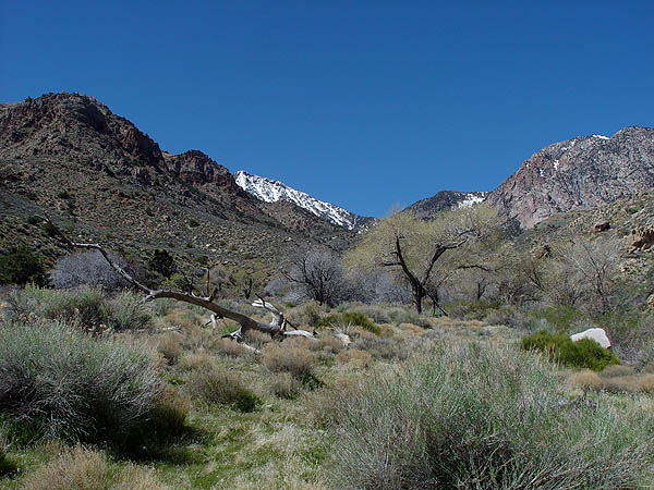
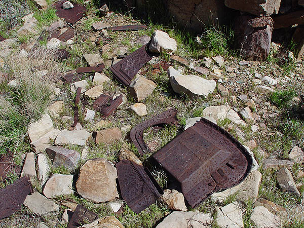
The next morning, we made sandwiches, packed up our Camelbacks, laced up our boots and set off for a 4 mile round trip hike up Johnson Canyon and to our destination for the day, Hungry Bills Ranch. Originally settled by Swiss farmers who grew fruits and vegetables for the gold miners at Panamint City just 10 miles to the west, the land was eventually homesteaded by a man from Shoshone named Hungry Bill. Anyway, on this day, the weather service was predicting a high of 95°F on the valley floor but due to the high altitude, I don't think it ever got more than 75°F all day and thank God for it too. The well traveled foot trail up to Hungry Bills Ranch is beautiful with the 9,636 foot Sentinel Peak in the foreground, but it is also rugged and moderately strenuous with multiple water crossings (be prepared to get your feet very wet) along the way. Some of the sights you will see along the way is an old grinding wheel, sections of irragation channel, automobile parts, bits and pieces of farm equipment (please leave everything in place and DO NOT take any souvenirs) and orchards with a few trees still bearing fruit. However, one of the most interesting things we saw was a long and segmented stone wall leading all the way up to the ranch.
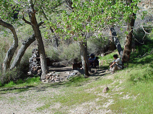
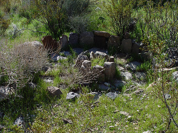
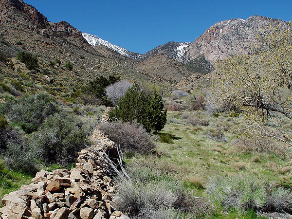
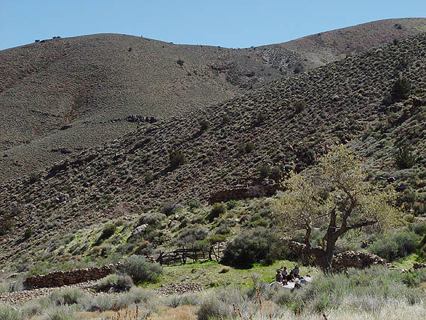
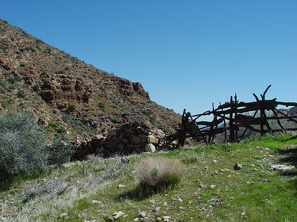
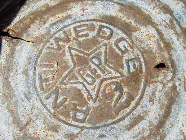
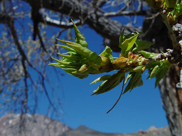
With the exception of a couple of stone ruins and stone wall encompassing a better part of the ranch, little remains at Hungry Bills Ranch. Much to my surprise, quite a few of the fruit trees here were still alive and budding. I also notices a lot of large animal droppings most likely from wild burros feeding on the fine grasses in the semi-enclosed and cleared field left behind. Within the ruins, you should see remnants of an old cast iron stove, wash bucket and even some farm tools. Again, please leave everything in places.
After a pleasant lunch and a nap on some boulders while we let our socks and shoes dry, we made our way back to camp and to dinner. |
 |
 |
 |
 |
 |
 |
 |
 |
 |
 |
 |
 |
 |
 |
 |
 |
 |
 |
 |
 |
 |
 |
 |
 |
 |
 |
 |
The following morning and last day in Death Valley, we packed up camp early and headed back down into the sweltering heat. Back at West End Road, we headed north until it hooked back up to the 178 and then headed south to Bad Water.
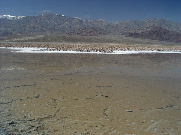
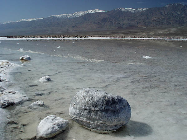
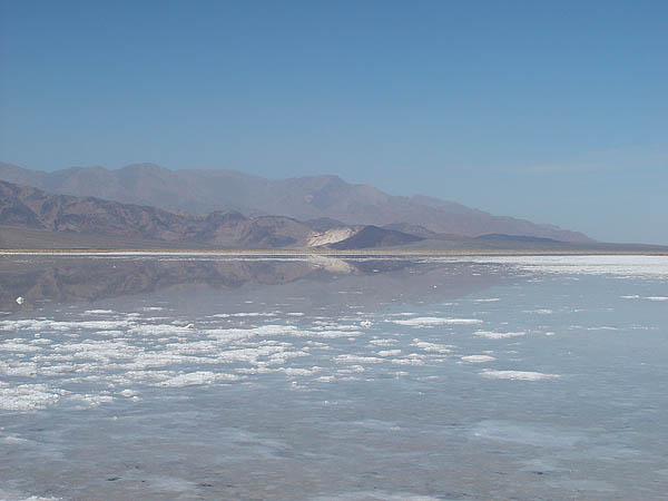
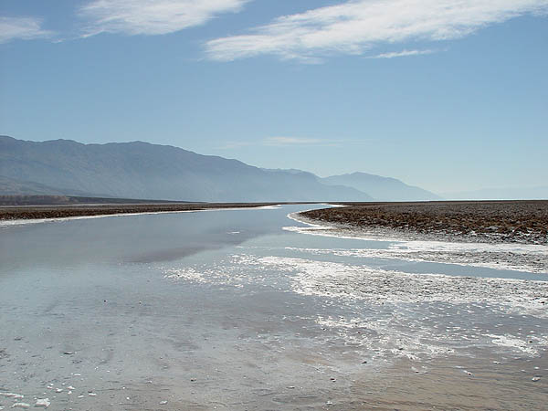
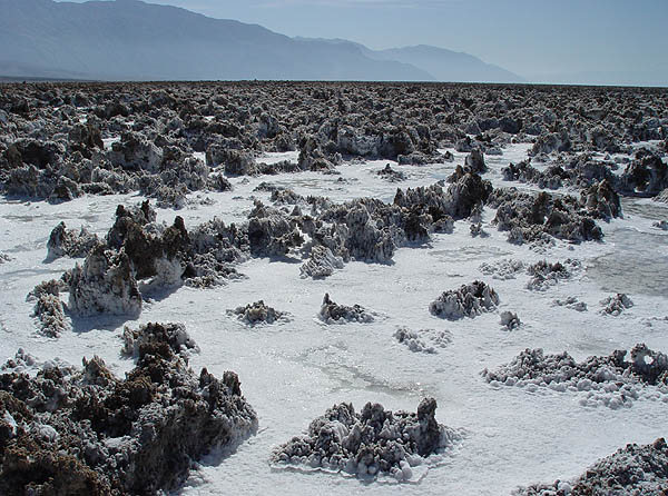
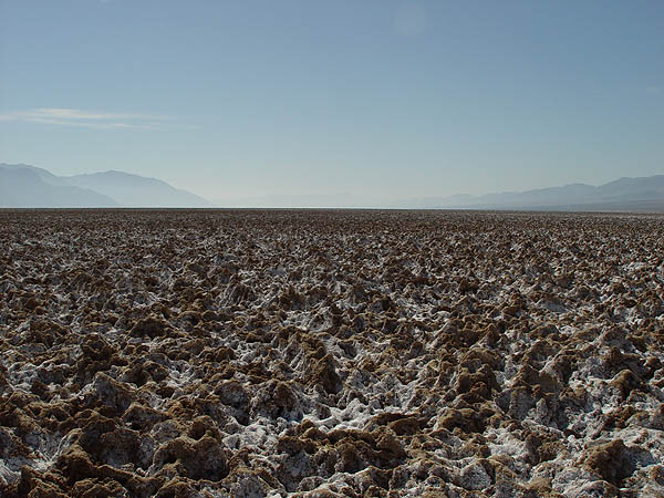
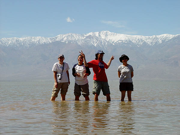
Bad water sits at 279.8 feet below sea level and is the lowest place accessible by vehicle in the western hemisphere. The area immediately adjacent to the parking area is filled with small pools of spring fed water year round but on most years, the salt flats to the west are completely dry, hard as a rock, white as snow and in some spots, uniquely sculpted. On a few of my visits to this area, the salt flats were covered with about an inch of water and you could walk out for what seemed like miles in it. However, for the very first time in my life, this place was completely full with knee deep water! It would seem that the bottom of Death Valley had become a Lake Death Valley with people kayaking on it. In all my years of visiting this wonderful place, this was by far the most stunning and unusual sight I had ever seen.
|
 |
 |
 |
 |
 |
 |
 |
 |
 |
Standing in the middle of "Lake Death Valley" looking towards
Telescope Peak |
From left to right, my wife Cindy, my good friends Yvonne & Eddie and Yvonne's mother on the right |
Looking back towards the Bad Water parking area and the Black Mountains |
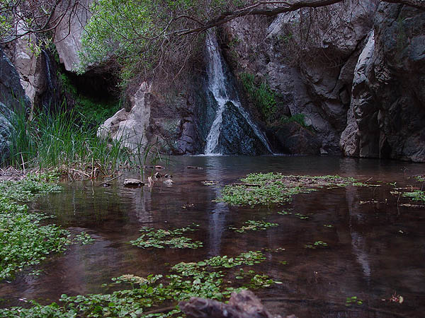
Leaving Bad Water, we headed north again, hooked up to the 190, gassed up at Furnace Creek, passed Stovepipe Wells and then made our way over the Panamint Range. Just on the opposite side of the Panamint Valley, we turned off on to a small dirt road and made our way to the last destination for the trip, Darwin Falls.
Off all our stops, this was maybe the most disappointing. Getting to the year round falls itself requires a short and easy 1 mile hike but at least when we were there, the trail was muddy from heavy foot traffic and there were just tons of people everywhere... Not exactly my idea of fun.
|
 |
 |
 |
Leaving Darwin Falls, we headed back to the Panamint Valley and then headed south to Ridgecrest. After a pleasant dinner at a local Mexican joint, we headed on home.
In all my years of visiting this incredible place we call Death Valley, I think it's fair to say that this was by far the very best trip I had ever experienced. I absolutely love this place and I'm always blown away by the life it has and the life it gives to me.
If you have any questions about my trip and/or about Death Valley in general, please feel free to contact me by email.
|
|
|